Loading...
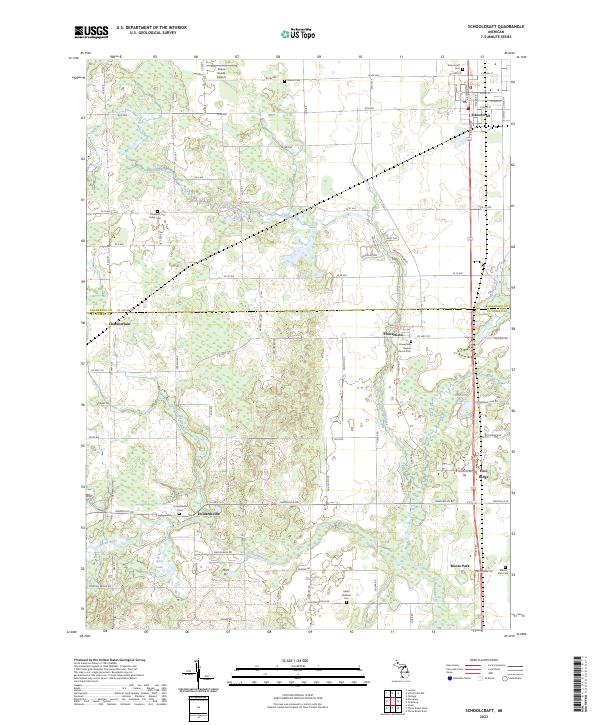
Loading map...2023 Map of Schoolcraft
USGS Topo · Published 2023About this map
Schoolcraft anchors the northeastern portion of this landscape, where the grid of W Lyons St and S Grand St meets the open agricultural plains of southern Michigan. The terrain is defined by a dense network of country roads, such as Co Line Rd marking the boundary between Kalamazoo and St. Joseph counties. Waterways like Flowerfield Creek and Rocky River wind through the township sections, supporting small clusters of settlement at Flowerfield and Howardsville.
Find a feature on this map
85 named features on this map. Tap any name to fly to it.
Don’t see what you’re looking for? This feature index may not catch every label — zoom into the map to look around manually.
Map Details
Date Portrayed2023
Date Published2023
PublisherU.S. Geological Survey
Map TypeTopographic
Scale1:24000
Physical Dimensions24 x 29 inches
Editions of this 2023 Schoolcraft Map
This is the sole edition of this map. No revisions or reprints were ever made.
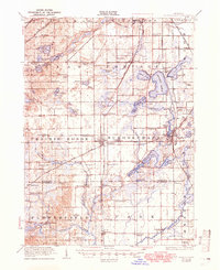
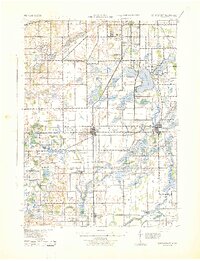
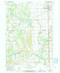
Historical Maps of Flowerfield Through Time
4 maps found
Featured Locations
- Flowerfield Township, MI
- Prairie Ronde Township, MI
- Schoolcraft, Schoolcraft Township
- Flowerfield, Flowerfield Township
- Moore Park, Park Township
Source Details
SourceU.S. Geological Survey
CopyrightPublic Domain