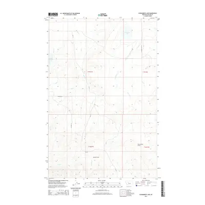
2014 Map of Schrammeck Lake
USGS Topo · Published 2014About this map
Schrammeck Lake sits at the northern edge of this high plains landscape in Cascade County, where the terrain is defined by a complex network of seasonal drainages and cattle-ranching roads. In the early 21st century, the area remains dominated by sweeping coulees, notably Spanish Coulee and Spring Willow Coulee, which channel water toward the various forks of the Missouri River system. The presence of Gollaher Reservoir and numerous creeks like Bird Cr, Willow Cr, and Huff Cr illustrates the critical role of water management in this arid Montana environment. Transportation is limited to functional rural routes such as Adel Rd and Whitmore Rd, which follow the contours of the land rather than a strict grid, reflecting the practical needs of local landowners and the constraints of the undulating topography.
Find a feature on this map
18 named features on this map. Tap any name to fly to it.
Don’t see what you’re looking for? This feature index may not catch every label — zoom into the map to look around manually.
Map Details
Editions of this 2014 Schrammeck Lake Map
This is the sole edition of this map. No revisions or reprints were ever made.
Other maps of this area

1886 · Great Falls
USGS Topo · 1:250,000

1949 · Cascade
USGS Topo · 1:62,500

1951 · Cascade
USGS Topo · 1:62,500

1954 · Great Falls
USGS Topo · 1:250,000

1955 · Gore Hill
USGS Topo · 1:62,500

1957 · Great Falls
USGS Topo · 1:250,000

1961 · Hound Creek Reservoir
USGS Topo · 1:24,000

1961 · Rocky Reef
USGS Topo · 1:24,000

1961 · Schrammeck Lake
USGS Topo · 1:24,000

1961 · Dana Ranch
USGS Topo · 1:24,000