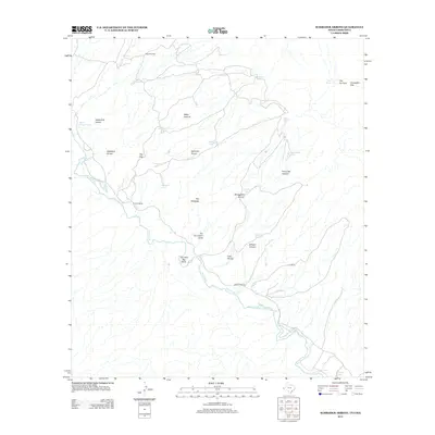
2012 Map of Schroder Arroyo
USGS Topo · Published 2012About this map
Rio Grande waters define the southern reaches of this landscape, where the river carves distinctive bends such as The Little Big Bend and leaves behind the crescent-shaped Oxbow Lake. The arid terrain is marked by a network of drainage systems like Schroder Arroyo and Asebuches Arroyo, alongside curiously named landmarks including The Ice Cream Cone and The Palisades. Human presence is sparse, centered on working agricultural sites such as Porcher Ranch and Love Ranch. Water management is critical in this borderland environment, evidenced by numerous tanks like Echo Tank and Escondido Tank, as well as the essential Deer Spring. Ranch Road 192 provides the primary transit corridor through the river valley, connecting the remote ranching outposts to the wider region.
Find a feature on this map
31 named features on this map. Tap any name to fly to it.
Don’t see what you’re looking for? This feature index may not catch every label — zoom into the map to look around manually.
Map Details
Editions of this 2012 Schroder Arroyo Map
This is the sole edition of this map. No revisions or reprints were ever made.
Other maps of this area

1894 · Fort Hancock
USGS Topo · 1:125,000

1895 · Sierra Blanca
USGS Topo · 1:125,000

1897 · Eagle Mountain
USGS Topo · 1:125,000

1916 · Eagle Mountain
USGS Topo · 1:125,000

1943 · Fort Quitman
USGS Topo · 1:62,500

1954 · Van Horn
USGS Topo · 1:250,000

1958 · Van Horn
USGS Topo · 1:250,000

1959 · Marfa
USGS Topo · 1:250,000

1964 · Devil Ridge
USGS Topo · 1:24,000

1964 · Sierra Blanca SW
USGS Topo · 1:24,000