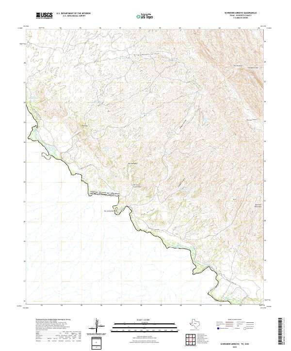
2022 Map of Schroder Arroyo
USGS Topo · Published 2022About this map
The Rio Grande serves as the international boundary between the United States and Mexico along this stretch of West Texas. The terrain is defined by the high ridges of the Quitman Mountains and the winding course of the river, which creates distinct features like the Little Big Bend and an Oxbow Lake near the southern edge of the quadrangle. High desert hydrology is evident in the numerous water tanks scattered throughout the canyons, such as Red Rock Tank, Camp Tank, and Escondido Tank, which were vital for livestock and survival in this arid environment.
Find a feature on this map
28 named features on this map. Tap any name to fly to it.
Don’t see what you’re looking for? This feature index may not catch every label — zoom into the map to look around manually.
Map Details
Editions of this 2022 Schroder Arroyo Map
This is the sole edition of this map. No revisions or reprints were ever made.
Other maps of this area

1894 · Fort Hancock
USGS Topo · 1:125,000

1895 · Sierra Blanca
USGS Topo · 1:125,000

1897 · Eagle Mountain
USGS Topo · 1:125,000

1916 · Eagle Mountain
USGS Topo · 1:125,000

1943 · Fort Quitman
USGS Topo · 1:62,500

1954 · Van Horn
USGS Topo · 1:250,000

1958 · Van Horn
USGS Topo · 1:250,000

1959 · Marfa
USGS Topo · 1:250,000

1964 · Devil Ridge
USGS Topo · 1:24,000

1964 · Sierra Blanca SW
USGS Topo · 1:24,000