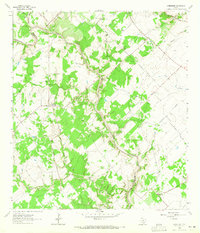
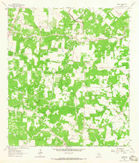
1964 Map of Schroeder
USGS Topo · Published 1965About this map
The settlement of Schroeder serves as a focal point in this mid-century landscape where Goliad and Victoria counties meet. The area is defined by a dense network of seasonal waterways including Hog Thief Creek, Gobbler Creek, and Turkey Creek, all feeding into the meandering course of Coleto Creek. Human presence is marked by rural infrastructure such as St Lukes Ch and scattered Gravel Pits, indicating a reliance on local materials for construction and road maintenance. To the east, the community of Coletoville is situated near several burial grounds including Mission Valley Cem and Woodlawn Cem. The presence of numerous wells and a prominent Pipeline cutting across the northern reaches reflects the region's involvement in energy extraction and resource transport during the early 1960s.
Find a feature on this map
30 named features on this map. Tap any name to fly to it.
Don’t see what you’re looking for? This feature index may not catch every label — zoom into the map to look around manually.
Map Details
Editions of this 1964 Schroeder Map
3 editions found
Other maps of this area

1953 · Beeville
USGS Topo · 1:250,000

1956 · Beeville
USGS Topo · 1:250,000

1960 · Beeville
USGS Topo · 1:250,000

1962 · Fannin
USGS Topo · 1:24,000

1962 · Hensley Lake
USGS Topo · 1:24,000

1962 · Raisin
USGS Topo · 1:24,000

1963 · Meyersville
USGS Topo · 1:24,000

1963 · Nursery
USGS Topo · 1:24,000
1963 · Mission Valley
USGS Topo · 1:24,000
1963 · Ander
USGS Topo · 1:24,000