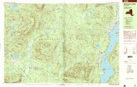
1995 Map of Schroon Lake
USGS Topo · Published 1999About this map
Adirondack Park peaks and water bodies dominate this survey, which captures the central Adirondacks during the mid-1990s. The landscape is defined by the significant corridor of Schroon Lake and its passage through the Narrows, where the village of Schroon Lake sits as a primary hub. To the west, the settlements of Minerva, Olmstedville, and the small cluster at Irishtown are linked by winding mountain roads and the path of the Minerva Stream.
Find a feature on this map
73 named features on this map. Tap any name to fly to it.
Don’t see what you’re looking for? This feature index may not catch every label — zoom into the map to look around manually.
Map Details
Editions of this 1995 Schroon Lake Map
This is the sole edition of this map. No revisions or reprints were ever made.
Other maps of this area

1895 · North Creek
USGS Topo · 1:62,500

1895 · Paradox Lake
USGS Topo · 1:62,500

1897 · Bolton
USGS Topo · 1:62,500

1897 · Paradox Lake
USGS Topo · 1:62,500

1897 · North Creek
USGS Topo · 1:62,500

1897 · Schroon Lake
USGS Topo · 1:62,500

1898 · Newcomb
USGS Topo · 1:62,500

1898 · Thirteenth Lake
USGS Topo · 1:62,500

1900 · Bolton
USGS Topo · 1:62,500

1901 · Newcomb
USGS Topo · 1:62,500