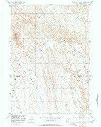
1951 Map of Schuster Flats NW
USGS Topo · Published 1978About this map
Red Butte rises as a prominent landmark in this high desert landscape, which was surveyed during the early 1950s as part of the Department of the Interior's Missouri River Basin development program. The terrain is defined by a series of branching drainage systems, with the northern expanse carved by Fivemile Creek while the southern reach is dominated by the winding course of Fifteenmile Creek. This map documents a transitional zone along the border of Big Horn Co and Washakie Co, where the land is largely shaped by natural watercourses like the North Fork and Middle Fork Tenmile Creek. These drainages suggest a landscape utilized for open-range grazing, punctuated only by vertical control points such as VABM Dorsey and VABM Pond. The lack of dense development underscores the arid, rural character of the region during this mid-century period.
Find a feature on this map
8 named features on this map. Tap any name to fly to it.
Don’t see what you’re looking for? This feature index may not catch every label — zoom into the map to look around manually.
Map Details
Editions of this 1951 Schuster Flats NW Map
2 editions found
Other maps of this area

1951 · Sucker Dam
USGS Topo · 1:24,000

1951 · Schuster Flats NE
USGS Topo · 1:24,000

1951 · Dutch Nick Flat
USGS Topo · 1:24,000

1951 · Schuster Flats
USGS Topo · 1:24,000

1951 · Schuster Flats NW
USGS Topo · 1:24,000

1951 · Schuster Flats SE
USGS Topo · 1:24,000

1951 · Wardel Reservoir
USGS Topo · 1:24,000

1955 · Cody
USGS Topo · 1:250,000

1958 · Cody
USGS Topo · 1:250,000

1962 · Cody
USGS Topo · 1:250,000