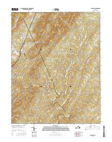
2016 Map of Schuyler
USGS Topo · Published 2016About this map
The Rockfish River carves through the transition between Nelson Co and Albemarle Co in this detailed 2016 survey. The village of Schuyler serves as a central hub, situated near the river and Gold Mine Ln, reflecting the area's geological and industrial heritage. To the north and west, the landscape is defined by the steep rises of Appleberry Mtn, Brush Mtn, and Butler Mtn.
Find a feature on this map
90 named features on this map. Tap any name to fly to it.
Don’t see what you’re looking for? This feature index may not catch every label — zoom into the map to look around manually.
Map Details
Editions of this 2016 Schuyler Map
This is the sole edition of this map. No revisions or reprints were ever made.
Other maps of this area

1892 · Buckingham
USGS Topo · 1:125,000

1929 · Covesville
USGS Topo · 1:62,500

1935 · Covesville
USGS Topo · 1:62,500

1943 · Lovingston
USGS Topo · 1:62,500

1945 · Covesville
USGS Topo · 1:62,500

1946 · Lovingston
USGS Topo · 1:62,500

1947 · Roanoke
USGS Topo · 1:250,000

1959 · Roanoke
USGS Topo · 1:250,000

1961 · Shipman
USGS Topo · 1:62,500

1961 · Buckingham
USGS Topo · 1:62,500