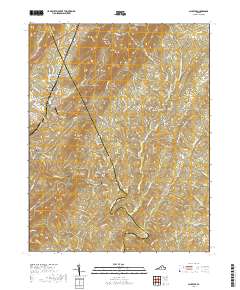
2019 Map of Schuyler
USGS Topo · Published 2019About this map
The Rockfish River winds through the heart of the Blue Ridge foothills on the border of Albemarle and Nelson counties, shaping the development of settlements like Schuyler and Faber. This 2019 survey documents a landscape defined by significant elevations, including Appleberry Mtn and Shiloh Mtn, which separate the various drainage basins of Green Cr and Hickory Cr. Historically rooted communities are evidenced by numerous local burial grounds such as Rock Spring Cem and Mount Shiloh Cem. The inclusion of Faber Airport and names like Old Dominion and Damon reflects the long-standing infrastructure and crossroads that have served this rural Virginia corridor. Researchers can trace the network of secondary routes, including the Monacan Trail Rd and Irish Rd, as they navigate the ridges and hollows that characterize this part of the Piedmont.
Find a feature on this map
98 named features on this map. Tap any name to fly to it.
Don’t see what you’re looking for? This feature index may not catch every label — zoom into the map to look around manually.
Map Details
Editions of this 2019 Schuyler Map
This is the sole edition of this map. No revisions or reprints were ever made.
Other maps of this area

1892 · Buckingham
USGS Topo · 1:125,000

1929 · Covesville
USGS Topo · 1:62,500

1935 · Covesville
USGS Topo · 1:62,500

1943 · Lovingston
USGS Topo · 1:62,500

1945 · Covesville
USGS Topo · 1:62,500

1946 · Lovingston
USGS Topo · 1:62,500

1947 · Roanoke
USGS Topo · 1:250,000

1959 · Roanoke
USGS Topo · 1:250,000

1961 · Shipman
USGS Topo · 1:62,500

1961 · Buckingham
USGS Topo · 1:62,500