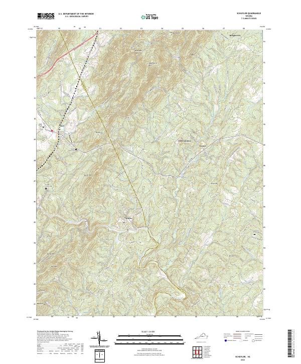
2022 Map of Schuyler
USGS Topo · Published 2022About this map
Schuyler and the surrounding Nelson County foothills are defined by the winding course of the Rockfish River, which cuts through a landscape of prominent peaks and deep hollows. The terrain is marked by significant elevations including Appleberry Mtn, Shiloh Mtn, and Butler Mtn, which frame the small settlements and local transport routes. This map provides a contemporary view of these traditional Piedmont communities, where names like Gold Mine Ln and Quarry Hill Ln hint at the area's geological and extractive history. Numerous family and community landmarks are preserved on the sheet, such as Mount Shiloh Cem and Chestnut Grove Cem. The presence of the Faber Airport near the community of Faber shows the modern infrastructure layered over the older paths of the Monacan Trail Rd.
Find a feature on this map
89 named features on this map. Tap any name to fly to it.
Don’t see what you’re looking for? This feature index may not catch every label — zoom into the map to look around manually.
Map Details
Editions of this 2022 Schuyler Map
This is the sole edition of this map. No revisions or reprints were ever made.
Other maps of this area

1892 · Buckingham
USGS Topo · 1:125,000

1929 · Covesville
USGS Topo · 1:62,500

1935 · Covesville
USGS Topo · 1:62,500

1943 · Lovingston
USGS Topo · 1:62,500

1945 · Covesville
USGS Topo · 1:62,500

1946 · Lovingston
USGS Topo · 1:62,500

1947 · Roanoke
USGS Topo · 1:250,000

1959 · Roanoke
USGS Topo · 1:250,000

1961 · Shipman
USGS Topo · 1:62,500

1961 · Buckingham
USGS Topo · 1:62,500