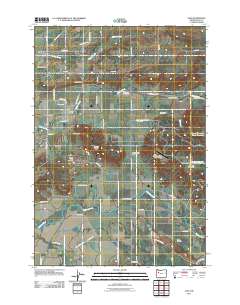
2011 Map of Scio
USGS Topo · Published 2011About this map
Scio sits at the heart of this agricultural landscape in Linn County, where the waters of Thomas Creek and Mill Creek converge. The town's layout is centered around the Scio Post Office, serving as a hub for the surrounding rural homesteads and valley farms. To the north, the community of Shelburn and the Miller Cemetery mark older centers of settlement, while the Leffler Grade hints at the historical rail paths that once moved timber and goods through the Willamette Valley foothills.
Find a feature on this map
58 named features on this map. Tap any name to fly to it.
Don’t see what you’re looking for? This feature index may not catch every label — zoom into the map to look around manually.
Map Details
Editions of this 2011 Scio Map
This is the sole edition of this map. No revisions or reprints were ever made.
Other maps of this area

1911 · Lebanon
USGS Topo · 1:31,680

1921 · Lebanon
USGS Topo · 1:62,500

1922 · Lebanon
USGS Topo · 1:48,000

1924 · Lebanon
USGS Topo · 1:62,500

1925 · Stayton
USGS Topo · 1:62,500

1940 · Lebanon
USGS Topo · 1:62,500

1941 · Stayton
USGS Topo · 1:62,500

1944 · Lebanon
USGS Topo · 1:62,500

1951 · Lyons
USGS Topo · 1:62,500

1951 · Snow Peak
USGS Topo · 1:62,500