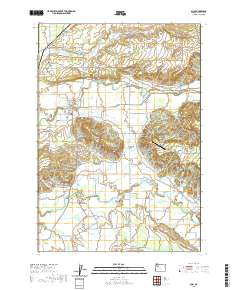
2020 Map of Scio
USGS Topo · Published 2020About this map
Scio and the surrounding Linn County farmlands are defined by the winding course of Thomas Creek and the notable passage of Richardson Gap. This modern survey reveals a landscape where historical burial grounds like Miller Cem, Franklin Butte Cem, and Gaines Cem are preserved alongside active agricultural and aviation features. The small settlements of Shelburn and Leffler Grade mark the northern reaches of the quadrangle, while the east is characterized by the elevation of Rogers Mtn. Practical infrastructure for the rural community is evidenced by structures such as Schimanek Bridge and Shindler Bridge, which facilitate transit across the complex network of waterways including Sucker Slough, Crabtree Creek, and Peters Ditch. The presence of The Green Trees Ranch Airport further highlights the integration of private land use within this established valley terrain.
Find a feature on this map
63 named features on this map. Tap any name to fly to it.
Don’t see what you’re looking for? This feature index may not catch every label — zoom into the map to look around manually.
Map Details
Editions of this 2020 Scio Map
This is the sole edition of this map. No revisions or reprints were ever made.
Other maps of this area

1911 · Lebanon
USGS Topo · 1:31,680

1921 · Lebanon
USGS Topo · 1:62,500

1922 · Lebanon
USGS Topo · 1:48,000

1924 · Lebanon
USGS Topo · 1:62,500

1925 · Stayton
USGS Topo · 1:62,500

1940 · Lebanon
USGS Topo · 1:62,500

1941 · Stayton
USGS Topo · 1:62,500

1944 · Lebanon
USGS Topo · 1:62,500

1951 · Lyons
USGS Topo · 1:62,500

1951 · Snow Peak
USGS Topo · 1:62,500