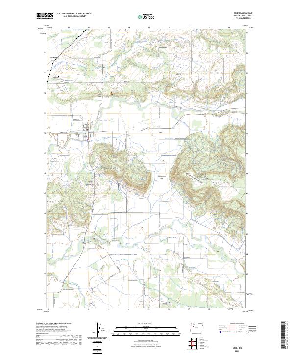
2023 Map of Scio
USGS Topo · Published 2023About this map
Scio sits at the heart of this Linn County landscape, where the waters of Thomas Creek and Mill Creek converge. The terrain is defined by a series of prominent rises including Franklin Butte, Hungry Hill, and Rogers Mtn, which disrupt the agricultural grid of the Willamette Valley. This area has long been a crossroads of rural life, evidenced by the scattered historic burial grounds like Miller Cem, Kotan Cem, and the Franklin Butte Masonic Cem. The map reveals a complex network of drainage and irrigation, with Sucker Slough and Peters Ditch winding through the lowlands north of the main settlement.
Find a feature on this map
61 named features on this map. Tap any name to fly to it.
Don’t see what you’re looking for? This feature index may not catch every label — zoom into the map to look around manually.
Map Details
Editions of this 2023 Scio Map
This is the sole edition of this map. No revisions or reprints were ever made.
Other maps of this area

1911 · Lebanon
USGS Topo · 1:31,680

1921 · Lebanon
USGS Topo · 1:62,500

1922 · Lebanon
USGS Topo · 1:48,000

1924 · Lebanon
USGS Topo · 1:62,500

1925 · Stayton
USGS Topo · 1:62,500

1940 · Lebanon
USGS Topo · 1:62,500

1941 · Stayton
USGS Topo · 1:62,500

1944 · Lebanon
USGS Topo · 1:62,500

1951 · Lyons
USGS Topo · 1:62,500

1951 · Snow Peak
USGS Topo · 1:62,500