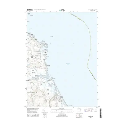
2015 Map of Scituate
USGS Topo · Published 2015About this map
Scituate and the adjacent shoreline of Plymouth County are defined by a series of prominent glacial drumlins known as the cliffs, stretching from First Cliff down to Fourth Cliff. This coastal landscape in 2015 reveals a complex network of tidal waterways, where the Herring River and South River wind through extensive salt marshes behind the barrier of Humarock Beach. The map shows the suburban density of settlements like Shore Acres and Sand Hills, juxtaposed with older sites of local history such as Union Cem and Meeting House Lane Cem. The interior transition is marked by elevations like Brushy Hill and Coleman Hills, while the maritime character is anchored by Cedar Point and the treacherous rocky outcroppings of Collamore Ledge and No Mans Ledge in the offshore waters.
Find a feature on this map
127 named features on this map. Tap any name to fly to it.
Don’t see what you’re looking for? This feature index may not catch every label — zoom into the map to look around manually.
Map Details
Editions of this 2015 Scituate Map
This is the sole edition of this map. No revisions or reprints were ever made.
Other maps of this area

1885 · Abington
USGS Topo · 1:62,500

1885 · Duxbury
USGS Topo · 1:62,500

1888 · Duxbury
USGS Topo · 1:62,500

1888 · Abington
USGS Topo · 1:62,500

1892 · Boston Bay
USGS Topo · 1:62,500

1893 · Abington
USGS Topo · 1:62,500

1893 · Duxbury
USGS Topo · 1:62,500

1903 · Boston Bay
USGS Topo · 1:62,500

1918 · Duxbury
USGS Topo · 1:62,500

1920 · Abington
USGS Topo · 1:62,500