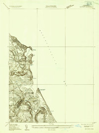
1935 Map of Scituate
USGS Topo · Published 1935About this map
Scituate Harbor and the surrounding coastline are defined by a complex network of salt marshes and tidal inlets in this 1935 survey. The maritime character of the area is highlighted by the Scituate Lighthouse and the presence of the US Naval Direction Finder Station near the mouth of the North River. The landscape reveals a seasonal and residential pattern typical of the mid-century South Shore, with distinct coastal settlements such as Rivermoor and Humarock separated by the winding paths of Moon Creek and the South River.
Find a feature on this map
41 named features on this map. Tap any name to fly to it.
Don’t see what you’re looking for? This feature index may not catch every label — zoom into the map to look around manually.
Map Details
Editions of this 1935 Scituate Map
This is the sole edition of this map. No revisions or reprints were ever made.
Other maps of this area

1885 · Abington
USGS Topo · 1:62,500

1885 · Duxbury
USGS Topo · 1:62,500

1888 · Duxbury
USGS Topo · 1:62,500

1888 · Abington
USGS Topo · 1:62,500

1892 · Boston Bay
USGS Topo · 1:62,500

1893 · Abington
USGS Topo · 1:62,500

1893 · Duxbury
USGS Topo · 1:62,500

1903 · Boston Bay
USGS Topo · 1:62,500

1918 · Duxbury
USGS Topo · 1:62,500

1920 · Abington
USGS Topo · 1:62,500