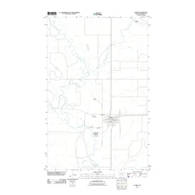
2011 Map of Scobey
USGS Topo · Published 2011About this map
The Poplar River and its major tributaries, the Middle Fork Poplar River and East Fork Poplar River, define the landscape of this northeastern Montana community. In Scobey, the county seat of Daniels County, the town layout is clearly established around Park St and C St. The town serves as a regional hub, evidenced by the presence of both the Scobey Vol Fire Dept and the Daniels Co Rural Fire Dept, alongside essential civic infrastructure like the Scobey Post Office. The map captures the community's social and agricultural anchors, including the Daniels County Fairgrounds and Scobey Cemetery. Transportation and recreation are well-documented through features such as the Scobey Airport, located just north of town, and the Scobey Golf Course situated near the riverbanks.
Find a feature on this map
25 named features on this map. Tap any name to fly to it.
Don’t see what you’re looking for? This feature index may not catch every label — zoom into the map to look around manually.
Map Details
Editions of this 2011 Scobey Map
This is the sole edition of this map. No revisions or reprints were ever made.
Other maps of this area

1954 · Wolf Point
USGS Topo · 1:250,000

1958 · Wolf Point
USGS Topo · 1:250,000

1973 · Madoc
USGS Topo · 1:24,000

1973 · Peerless 4 NE
USGS Topo · 1:24,000

1973 · Line Coulee
USGS Topo · 1:24,000

1973 · Scobey
USGS Topo · 1:24,000

1973 · Scobey NW
USGS Topo · 1:24,000

1973 · Cabarett Coulee
USGS Topo · 1:24,000

1973 · Four Buttes NE
USGS Topo · 1:24,000

1973 · Si Merrell Slough
USGS Topo · 1:24,000