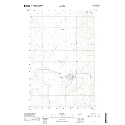
2020 Map of Scobey
USGS Topo · Published 2020About this map
The town of Scobey serves as the focal point of this Daniels County landscape, situated where the high plains meet the intricate drainage patterns of the northern Montana prairie. As the seat of local government, the Daniels County Courthouse anchors the small grid of city streets, including residential avenues from 1st Ave E to 6th Ave. The surrounding terrain is defined by dry coulees and creeks that have carved deep into the landscape over millennia, such as Butte Cr and the winding Shannon Coulee.
Find a feature on this map
35 named features on this map. Tap any name to fly to it.
Don’t see what you’re looking for? This feature index may not catch every label — zoom into the map to look around manually.
Map Details
Editions of this 2020 Scobey Map
This is the sole edition of this map. No revisions or reprints were ever made.
Other maps of this area

1954 · Wolf Point
USGS Topo · 1:250,000

1958 · Wolf Point
USGS Topo · 1:250,000

1973 · Madoc
USGS Topo · 1:24,000

1973 · Peerless 4 NE
USGS Topo · 1:24,000

1973 · Line Coulee
USGS Topo · 1:24,000

1973 · Scobey
USGS Topo · 1:24,000

1973 · Scobey NW
USGS Topo · 1:24,000

1973 · Cabarett Coulee
USGS Topo · 1:24,000

1973 · Four Buttes NE
USGS Topo · 1:24,000

1973 · Si Merrell Slough
USGS Topo · 1:24,000