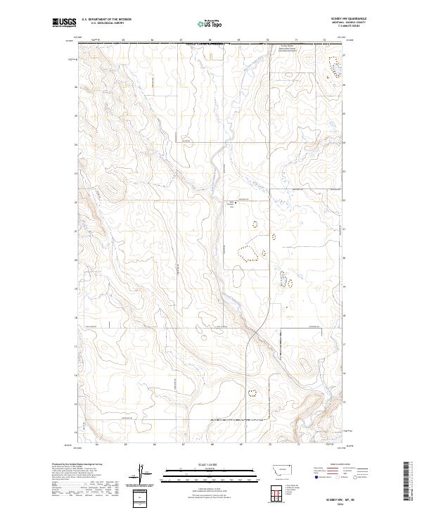
2024 Map of Scobey NW
USGS Topo · Published 2024About this map
The East Fork Poplar River meanders south through the northern plains of Daniels County, Montana, just below the international border with Canada. This rural landscape is defined by its deep agricultural and immigrant roots, evidenced by family-named thoroughfares such as Hudyma Rd, Mastenec Rd, and Ukrainian Rd. At the heart of the community stands Saint Michaels Cem, located along Cemetery Rd, serving as a vital landmark for genealogists researching the homesteading families of this high prairie region. To the north, the Scobey Border Station/East Poplar International Airport marks the transition between nations. Evidence of local industry and natural resources is preserved in labels like Coal Mine Rd, while Outlet Creek feeds into the primary river system that shaped the early settlement patterns of these townships.
Find a feature on this map
21 named features on this map. Tap any name to fly to it.
Don’t see what you’re looking for? This feature index may not catch every label — zoom into the map to look around manually.
Map Details
Editions of this 2024 Scobey NW Map
This is the sole edition of this map. No revisions or reprints were ever made.
Other maps of this area

1954 · Wolf Point
USGS Topo · 1:250,000

1958 · Wolf Point
USGS Topo · 1:250,000

1973 · Madoc
USGS Topo · 1:24,000

1973 · Scobey
USGS Topo · 1:24,000

1973 · Scobey NW
USGS Topo · 1:24,000

1973 · Four Buttes NE
USGS Topo · 1:24,000

1973 · Si Merrell Slough
USGS Topo · 1:24,000

1973 · Four Buttes
USGS Topo · 1:24,000

1983 · Scobey
USGS Topo · 1:100,000
2011 · Four Buttes
USGS Topo · 1:24,000