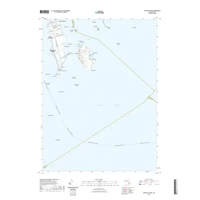
2021 Map of Sconticut Neck
USGS Topo · Published 2021About this map
Sconticut Neck and its surrounding archipelago define this coastal landscape at the southeastern edge of Bristol County. The residential developments of Winsegansett Heights occupy the narrow peninsula, where local genealogy is anchored at Delano Cem. To the east, Causeway Rd provides the primary link across the Sconticut Neck Marshes to West Island, a prominent landmass featuring residential grids like Ebony St and Balsam St alongside the preserved West Island Marshes.
Find a feature on this map
62 named features on this map. Tap any name to fly to it.
Don’t see what you’re looking for? This feature index may not catch every label — zoom into the map to look around manually.
Map Details
Editions of this 2021 Sconticut Neck Map
This is the sole edition of this map. No revisions or reprints were ever made.
Other maps of this area

1885 · New Bedford
USGS Topo · 1:62,500

1886 · Falmouth
USGS Topo · 1:62,500

1887 · Gay Head
USGS Topo · 1:62,500

1888 · New Bedford
USGS Topo · 1:62,500

1888 · Falmouth
USGS Topo · 1:62,500

1889 · Gay Head
USGS Topo · 1:62,500

1893 · Gay Head
USGS Topo · 1:62,500

1893 · Falmouth
USGS Topo · 1:62,500

1893 · New Bedford
USGS Topo · 1:62,500

1915 · Falmouth
USGS Topo · 1:62,500