
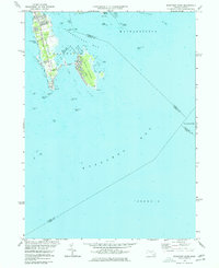
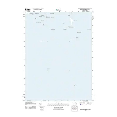
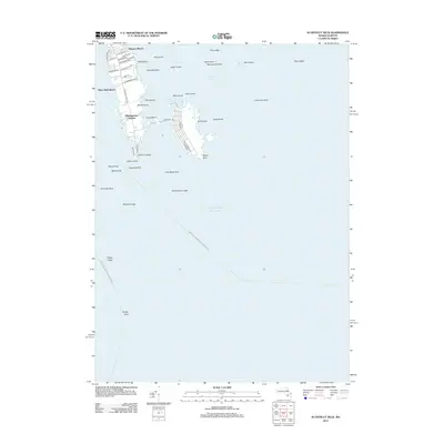
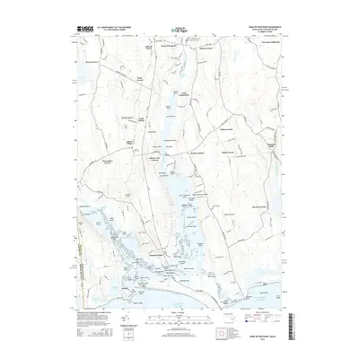
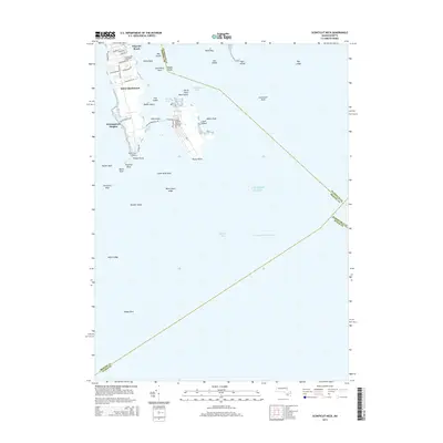
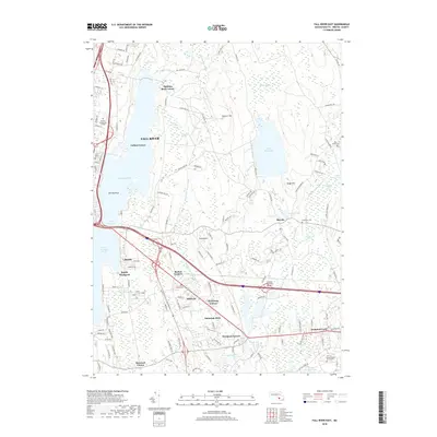
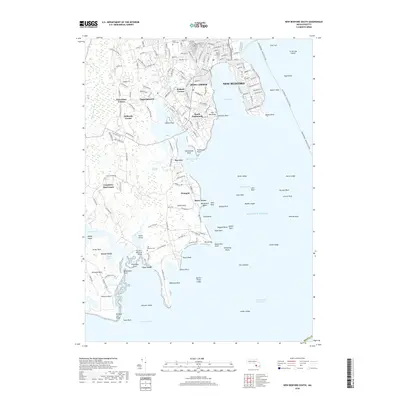
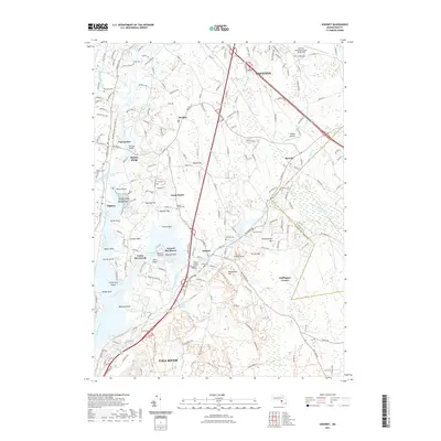
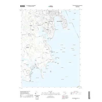
1975 Map of Sconticut Neck
USGS Topo · Published 1978About this map
West Island and the slender peninsula of Sconticut Neck define the coastal character of Fairhaven in this mid-1970s survey. The landscape is dominated by the complex shoreline of Nasketucket Bay, where small islands like Pea Island, Fish Island, and Round Island dot the shallow waters. A prominent Causeway connects the mainland to the residential streets of the island, including West Island Street, illustrating the area's development as a coastal community.
Find a feature on this map
45 named features on this map. Tap any name to fly to it.
Don’t see what you’re looking for? This feature index may not catch every label — zoom into the map to look around manually.
Map Details
Editions of this 1975 Sconticut Neck Map
2 editions found
Historical Maps of Falmouth Through Time
80 maps found

1893 Fairhaven
Bristol County, MA

1936 New Bedford North
Bristol County, MA

1936 South Dartmouth
Bristol County, MA

1940 Sconticut Neck
Bristol County, MA

1941 New Bedford North
Bristol County, MA

1941 New Bedford South
Bristol County, MA

1943 Assonet
Bristol County, MA

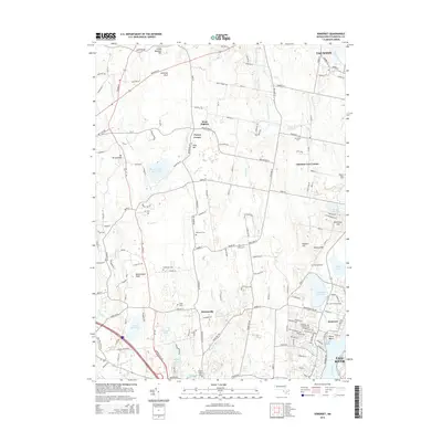
1943 Somerset
Bristol County, MA

1944 Fall River East
Bristol County, MA

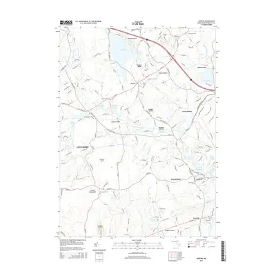
1944 Norton
Bristol County, MA

1948 New Bedford North
Bristol County, MA

1948 New Bedford South
Bristol County, MA

1948 Sconticut Neck
Bristol County, MA

1948 Somerset
Bristol County, MA

1951 Assonet
Bristol County, MA

1951 Fall River East
Bristol County, MA

1951 Norton
Bristol County, MA

1962 Sconticut Neck
Bristol County, MA

1963 Assonet
Bristol County, MA

1963 Fall River East
Bristol County, MA

1963 New Bedford South
Bristol County, MA

1964 New Bedford North
Bristol County, MA

1964 Norton
Bristol County, MA

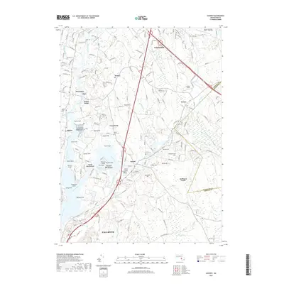
1967 Somerset
Bristol County, MA
1975 Sconticut Neck
Bristol County, MA

1977 Assonet
Bristol County, MA

1977 Fall River East
Bristol County, MA

1977 New Bedford North
Bristol County, MA

1977 New Bedford South
Bristol County, MA

1977 Norton
Bristol County, MA

1977 Sconticut Neck
Bristol County, MA

1977 Somerset
Bristol County, MA

1979 New Bedford North
Bristol County, MA

1985 Somerset
Bristol County, MA

1985 Westport
Bristol County, MA
2012 Assonet
Bristol County, MA
2012 Fall River East
Bristol County, MA
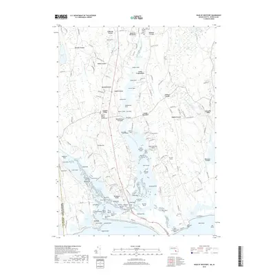
2012 Head of Westport
Bristol County, MA
2012 Head of Westport OE S
Bristol County, MA
2012 New Bedford North
Bristol County, MA
2012 New Bedford South
Bristol County, MA
2012 Norton
Bristol County, MA
2012 Sconticut Neck
Bristol County, MA
2012 Somerset
Bristol County, MA
2015 Assonet
Bristol County, MA
2015 Fall River East
Bristol County, MA
2015 Head of Westport
Bristol County, MA
2015 Head of Westport OE S
Bristol County, MA
2015 New Bedford North
Bristol County, MA
2015 New Bedford South
Bristol County, MA
2015 Norton
Bristol County, MA
2015 Sconticut Neck
Bristol County, MA
2015 Somerset
Bristol County, MA
2018 Assonet
Bristol County, MA
2018 Fall River East
Bristol County, MA
2018 Head of Westport
Bristol County, MA
2018 Head of Westport OE S
Bristol County, MA
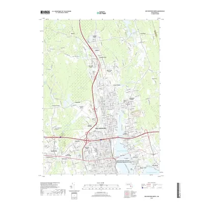
2018 New Bedford North
Bristol County, MA
2018 New Bedford South
Bristol County, MA
2018 Norton
Bristol County, MA
2018 Sconticut Neck
Bristol County, MA
2018 Somerset
Bristol County, MA
2021 Assonet
Bristol County, MA
2021 Fall River East
Bristol County, MA
2021 Head of Westport
Bristol County, MA

2021 Head of Westport OE S
Bristol County, MA
2021 New Bedford North
Bristol County, MA
2021 New Bedford South
Bristol County, MA
2021 Norton
Bristol County, MA
2021 Sconticut Neck
Bristol County, MA
2021 Somerset
Bristol County, MA

2024 Assonet
Bristol County, MA

2024 Fall River East
Bristol County, MA

2024 Head of Westport
Bristol County, MA

2024 Head of Westport OE S
Bristol County, MA

2024 New Bedford North
Bristol County, MA

2024 New Bedford South
Bristol County, MA

2024 Norton
Bristol County, MA

2024 Sconticut Neck
Bristol County, MA

2024 Somerset
Bristol County, MA