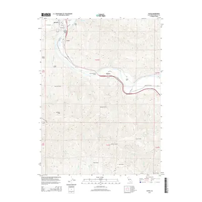
2015 Map of Scotia
USGS Topo · Published 2015About this map
The Eel River defines the central geography of this 2015 study, carving a wide valley that separates the developed settlements of Rio Dell and Scotia from the upland ridges. This area showcases the logistical importance of the river corridor, where the Redwood HWY and Avenue of the Giants parallel the water's path through the redwood country. Notable crossings like the Murphy Memorial Bridge and Fleisher Memorial Bridge connect these communities to the rugged eastern terrain near Stafford. To the south and west, the landscape transitions into a series of named openings and ridges, including Moores Prairie, Giacomini Prairie, and Monument Ridge. The map details a complex network of drainages such as Bear River and Jordan Cr, which flow through the southern portion of the quadrangle toward Mt Pierce and the heights of Peavine Ridge.
Find a feature on this map
60 named features on this map. Tap any name to fly to it.
Don’t see what you’re looking for? This feature index may not catch every label — zoom into the map to look around manually.
Map Details
Editions of this 2015 Scotia Map
This is the sole edition of this map. No revisions or reprints were ever made.
Other maps of this area

1919 · Glynn
USGS Topo · 1:62,500

1921 · Dyerville
USGS Topo · 1:62,500

1922 · Kneeland
USGS Topo · 1:62,500

1944 · Fortuna
USGS Topo · 1:62,500

1949 · Eureka
USGS Topo · 1:250,000

1949 · Weott
USGS Topo · 1:62,500

1950 · Iaqua Buttes
USGS Topo · 1:62,500

1950 · Scotia
USGS Topo · 1:62,500

1951 · Scotia
USGS Topo · 1:62,500

1951 · Weott
USGS Topo · 1:62,500