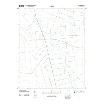
2010 Map of Scotia
USGS Topo · Published 2010About this map
Scotia stands at the northern edge of this coastal North Carolina landscape, where a grid-like network of rural roads and canals defines the agricultural and timber-driven character of Tyrrell County. The map reveals the intricate drainage systems necessary for this low-lying region, anchored by the Basnight Canal and the natural winding path of the Northwest Fork Alligator River to the south. Local transit is facilitated by routes such as Gum Neck Rd and the evocatively named Frying Pan Rd, which navigate the reclaimed swamp lands and timber tracts. This survey provides a precise look at the hydrology of the area, including Juniper Creek, illustrating the delicate balance between the natural wetlands and the maintained infrastructure of the early 21st century.
Find a feature on this map
12 named features on this map. Tap any name to fly to it.
Don’t see what you’re looking for? This feature index may not catch every label — zoom into the map to look around manually.
Map Details
Editions of this 2010 Scotia Map
This is the sole edition of this map. No revisions or reprints were ever made.
Other maps of this area

1943 · Columbia
USGS Topo · 1:125,000

1953 · Fairfield NE
USGS Topo · 1:24,000

1953 · Columbia East
USGS Topo · 1:24,000

1953 · Scotia
USGS Topo · 1:24,000

1953 · Columbia West
USGS Topo · 1:24,000

1953 · Frying Pan
USGS Topo · 1:24,000

1953 · Fairfield NW
USGS Topo · 1:24,000
1953 · Fort Landing
USGS Topo · 1:24,000

1953 · Rocky Mount
USGS Topo · 1:250,000

1954 · Rocky Mount
USGS Topo · 1:250,000