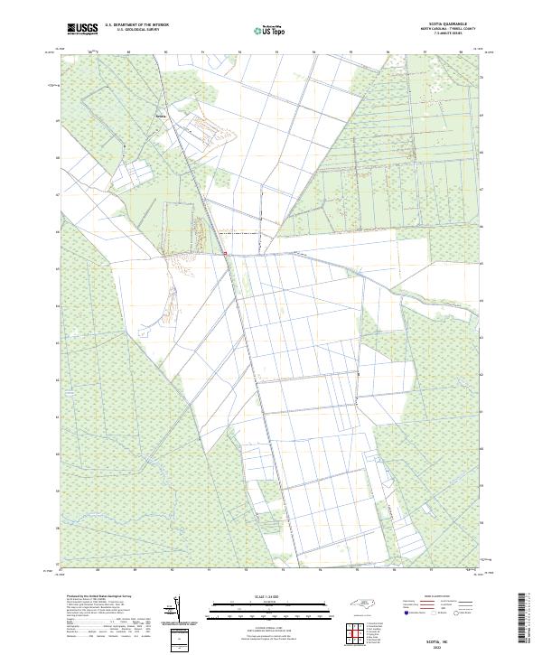
2022 Map of Scotia
USGS Topo · Published 2022About this map
Scotia stands as the primary settlement in this low-lying region of Tyrrell County, where the landscape is defined by an intricate network of drainage and natural watercourses. The local geography is a patchwork of managed timber or agricultural tracts carved out of the expansive Hollow Ground Swamp. Significant waterways like the Northwest Fork Alligator River and the engineered Basnight Canal illustrate the historic and ongoing efforts to manage the water levels of this coastal plain environment. The road network, including Frying Pan Rd and Burton Shell Rd, follows the slightly higher ground or follows the rigid geometry of the canal systems. This area represents a classic example of the Carolina coastal wetlands, where human habitation at Scotia is closely tied to the surrounding environment of Juniper Cr and Coopers Cr.
Find a feature on this map
11 named features on this map. Tap any name to fly to it.
Don’t see what you’re looking for? This feature index may not catch every label — zoom into the map to look around manually.
Map Details
Editions of this 2022 Scotia Map
This is the sole edition of this map. No revisions or reprints were ever made.
Other maps of this area

1943 · Columbia
USGS Topo · 1:125,000

1953 · Fairfield NE
USGS Topo · 1:24,000

1953 · Columbia East
USGS Topo · 1:24,000

1953 · Scotia
USGS Topo · 1:24,000

1953 · Columbia West
USGS Topo · 1:24,000

1953 · Frying Pan
USGS Topo · 1:24,000

1953 · Fairfield NW
USGS Topo · 1:24,000
1953 · Fort Landing
USGS Topo · 1:24,000

1953 · Rocky Mount
USGS Topo · 1:250,000

1954 · Rocky Mount
USGS Topo · 1:250,000