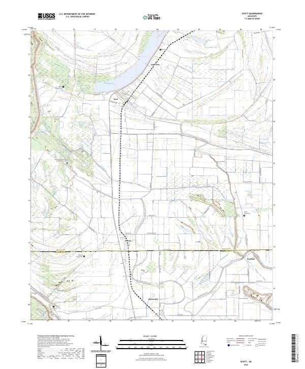
2024 Map of Scott
USGS Topo · Published 2024About this map
Scott and Lamont sit within a highly structured agricultural landscape at the border of Bolivar and Washington counties. This 2024 survey reveals a territory defined by intricate water management, where Bull Bayou, Williams Bayou, and Straight Bayou thread between large-scale fields. The settlement pattern is deeply connected to family and community history, evidenced by a high density of rural burial grounds such as Saint John's Missionary Baptist Church Cem and Williams Chapel Cem. In the southern portion of the quadrangle, Winterville and Forkland anchor a network of local roads including Slab Rd and Wilkerson Rd. The prominent curves of Lake Bolivar and Lake Vista suggest the ancient movements of the Mississippi River, leaving behind a fertile plain now dominated by rectangular land divisions and a strictly organized transportation grid.
Find a feature on this map
55 named features on this map. Tap any name to fly to it.
Don’t see what you’re looking for? This feature index may not catch every label — zoom into the map to look around manually.
Map Details
Editions of this 2024 Scott Map
This is the sole edition of this map. No revisions or reprints were ever made.
Other maps of this area

1933 · Lamont
USGS Topo · 1:62,500

1939 · Refuge
USGS Topo · 1:62,500

1939 · Lamont
USGS Topo · 1:62,500

1939 · Tralake
USGS Topo · 1:62,500

1939 · Choctaw
USGS Topo · 1:62,500

1953 · Greenwood
USGS Topo · 1:250,000

1956 · Greenwood
USGS Topo · 1:250,000

1967 · Stringtown
USGS Topo · 1:24,000

1967 · Leland
USGS Topo · 1:24,000

1967 · Lobdell
USGS Topo · 1:24,000