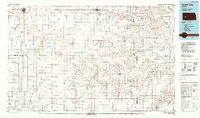
1985 Map of Scott City
USGS Topo · Published 1988About this map
Scott City and Garden City anchor this mid-1980s topographical study of western Kansas, a region defined by its intensive irrigation systems and agricultural geography. The landscape is bisected by the Great Eastern Ditch, Farmers Ditch, and the Garden City Canal, reflecting the massive engineering required to manage water in the High Plains. To the north and west, the terrain is characterized by large drainage basins like the White Woman Basin and the winding course of the Walnut River.
Find a feature on this map
57 named features on this map. Tap any name to fly to it.
Don’t see what you’re looking for? This feature index may not catch every label — zoom into the map to look around manually.
Map Details
Editions of this 1985 Scott City Map
2 editions found
Other maps of this area

1891 · Larned
USGS Topo · 1:125,000

1892 · Ness
USGS Topo · 1:125,000

1892 · Dodge
USGS Topo · 1:125,000

1892 · Spearville
USGS Topo · 1:125,000

1893 · Ellis
USGS Topo · 1:125,000

1894 · Spearville
USGS Topo · 1:125,000

1894 · Ness
USGS Topo · 1:125,000

1896 · Garden
USGS Topo · 1:125,000

1900 · Lakin
USGS Topo · 1:125,000

1939 · Sandon
USGS Topo · 1:62,500