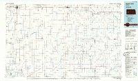
1985 Map of Scott City
USGS Topo · Published 1985About this map
Scott City and Dighton anchor this Western Kansas landscape as it appeared in the mid-1980s, revealing a region defined by agricultural water systems and early energy extraction. The map captures the course of the Walnut Creek and the Pawnee River as they traverse the high plains, alongside unique local drainage features like the White Woman Bottoms and Horse Thief Canyon.
Find a feature on this map
40 named features on this map. Tap any name to fly to it.
Don’t see what you’re looking for? This feature index may not catch every label — zoom into the map to look around manually.
Map Details
Editions of this 1985 Scott City Map
2 editions found
Other maps of this area

1891 · Larned
USGS Topo · 1:125,000

1892 · Ness
USGS Topo · 1:125,000

1892 · Dodge
USGS Topo · 1:125,000

1892 · Spearville
USGS Topo · 1:125,000

1893 · Ellis
USGS Topo · 1:125,000

1894 · Spearville
USGS Topo · 1:125,000

1894 · Ness
USGS Topo · 1:125,000

1896 · Garden
USGS Topo · 1:125,000

1900 · Lakin
USGS Topo · 1:125,000

1939 · Sandon
USGS Topo · 1:62,500