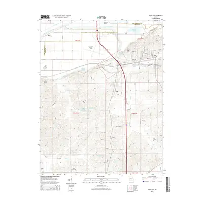
2015 Map of Scott City
USGS Topo · Published 2015About this map
Scott City and the neighboring settlements of Illmo and Kelso occupy a landscape deeply shaped by drainage and water management. The massive Castor River Diversion Channel and Dutchtown Ditch dominate the northern terrain, redirecting flow across the Black Land Bottom. In the southern portion of the quadrangle, the community of New Hamburg sits amidst a network of smaller water bodies like Mothershead Lake and Draper Lake. This area reflects a complex history of land reclamation and regional transportation, anchored by the Cape Girardeau Regional Airport and several rail lines including the Mo-Ab and Mo-PP. For local historians and genealogists, the map reveals numerous burial sites, including the Ancell Cemetery, Westerwell Cemetery, and Mount Zion Cemetery, which provide clues to the early families who settled this fertile river valley.
Find a feature on this map
82 named features on this map. Tap any name to fly to it.
Don’t see what you’re looking for? This feature index may not catch every label — zoom into the map to look around manually.
Map Details
Editions of this 2015 Scott City Map
This is the sole edition of this map. No revisions or reprints were ever made.
Other maps of this area

1920 · Jonesboro
USGS Topo · 1:62,500

1922 · Cape Girardeau
USGS Topo · 1:62,500

1923 · Jonesboro
USGS Topo · 1:62,500

1924 · Cape Girardeau
USGS Topo · 1:62,500

1934 · Thebes
USGS Topo · 1:62,500

1934 · Morley
USGS Topo · 1:62,500

1939 · Morley
USGS Topo · 1:62,500

1939 · Thebes
USGS Topo · 1:62,500

1947 · Jonesboro
USGS Topo · 1:62,500

1947 · Mc Clure
USGS Topo · 1:24,000