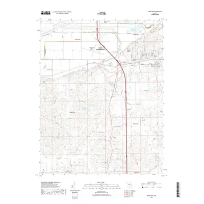
2017 Map of Scott City
USGS Topo · Published 2017About this map
Scott City and its neighboring communities of Illmo and Ancell dominate the northeastern corner of this 2017 survey, situated just south of the Cape Girardeau city limits. This landscape is defined by extensive water management systems, including the Castor River Diversion Channel and the Ramsey Cr Diversion Channel, which navigate the low-lying Black Land Bottom and Big Swamp areas. These engineering works reflect a long history of reclaiming fertile Mississippi River floodplain for agricultural and industrial use.
Find a feature on this map
77 named features on this map. Tap any name to fly to it.
Don’t see what you’re looking for? This feature index may not catch every label — zoom into the map to look around manually.
Map Details
Editions of this 2017 Scott City Map
This is the sole edition of this map. No revisions or reprints were ever made.
Other maps of this area

1920 · Jonesboro
USGS Topo · 1:62,500

1922 · Cape Girardeau
USGS Topo · 1:62,500

1923 · Jonesboro
USGS Topo · 1:62,500

1924 · Cape Girardeau
USGS Topo · 1:62,500

1934 · Thebes
USGS Topo · 1:62,500

1934 · Morley
USGS Topo · 1:62,500

1939 · Morley
USGS Topo · 1:62,500

1939 · Thebes
USGS Topo · 1:62,500

1947 · Jonesboro
USGS Topo · 1:62,500

1947 · Mc Clure
USGS Topo · 1:24,000