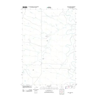
2012 Map of Scott Creek
USGS Topo · Published 2012About this map
The Little Missouri River meanders across the eastern edge of this Harding County landscape, creating a serpentine corridor through the high plains. This remote corner of South Dakota is defined by its drainage network and isolated landmarks, notably the Tennant Ranch Airport and the specialized crossing at Salmen Ford. The terrain rises at distinct points such as Bleak Butte and Profile Butte, which serve as natural navigation marks above the numerous drainages like Scott Cr, Wagoneer Cr, and Dipping Vat Cr. The presence of roads like Co HWY-887 and Co HWY-988 suggests a thin but vital infrastructure supporting the ranching economy. This 2012 survey illustrates a landscape where named water features like Seal Draw and Stony Cr are essential identifiers in a sparsely populated territory.
Find a feature on this map
15 named features on this map. Tap any name to fly to it.
Don’t see what you’re looking for? This feature index may not catch every label — zoom into the map to look around manually.
Map Details
Editions of this 2012 Scott Creek Map
This is the sole edition of this map. No revisions or reprints were ever made.
Other maps of this area

1935 · Buffalo
USGS Topo · 1:125,000

1954 · Lemmon
USGS Topo · 1:250,000

1954 · Ekalaka
USGS Topo · 1:250,000

1956 · Ekalaka
USGS Topo · 1:250,000

1957 · Lemmon
USGS Topo · 1:250,000

1958 · Ekalaka
USGS Topo · 1:250,000

1965 · Ekalaka
USGS Topo · 1:250,000

1973 · Gallup Creek
USGS Topo · 1:24,000

1974 · Caroline Butte
USGS Topo · 1:24,000
1977 · Scott Creek
USGS Topo · 1:24,000