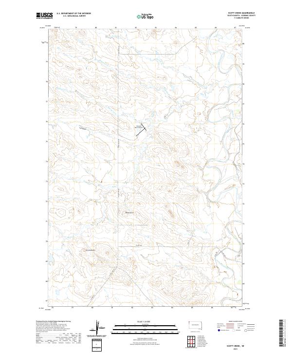
2021 Map of Scott Creek
USGS Topo · Published 2021About this map
Tennant Ranch Airport provides a rare point of modern infrastructure in this sparsely settled corner of Harding County, where the high plains landscape is defined by the winding course of the Little Missouri River. The river's serpentine bends dominate the eastern portion of the quadrangle, carving into the terrain alongside named tributaries like Shaw Cr and Wagoneer Cr. Significant landmarks like Bleak Butte and Profile Butte rise above the drainage basins, serving as critical orientation points in a territory largely organized by large-scale ranching and sectional land divisions. A network of rural routes, including N Camp Cook Rd and Co Hwy 988, connects the various draws and creek beds, illustrating the isolation and resilience of life in the northwestern South Dakota cattle country.
Find a feature on this map
22 named features on this map. Tap any name to fly to it.
Don’t see what you’re looking for? This feature index may not catch every label — zoom into the map to look around manually.
Map Details
Editions of this 2021 Scott Creek Map
This is the sole edition of this map. No revisions or reprints were ever made.
Other maps of this area

1935 · Buffalo
USGS Topo · 1:125,000

1954 · Lemmon
USGS Topo · 1:250,000

1954 · Ekalaka
USGS Topo · 1:250,000

1956 · Ekalaka
USGS Topo · 1:250,000

1957 · Lemmon
USGS Topo · 1:250,000

1958 · Ekalaka
USGS Topo · 1:250,000

1965 · Ekalaka
USGS Topo · 1:250,000

1973 · Gallup Creek
USGS Topo · 1:24,000

1974 · Caroline Butte
USGS Topo · 1:24,000
1977 · Scott Creek
USGS Topo · 1:24,000