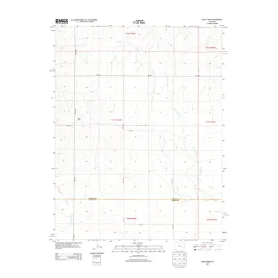
2013 Map of Scott Draw
USGS Topo · Published 2013About this map
The high plains of eastern Colorado converge at the border of Lincoln Co and Kiowa Co, where the landscape is defined by the ephemeral drainages that feed the Arkansas River watershed. The terrain is marked by the eponymous Scott Draw and the meandering course of Adobe Cr, which branches into its E Fork Adobe Cr in the northeastern reaches of the map. This early 21st-century survey illustrates a sparsely populated agricultural and ranching landscape organized by a rigid grid of county roads. Names like Co Road 109 and Co Road F delineate section lines typical of the Public Land Survey System, while the presence of N Fork Mustang Cr in the southwest corner provides further evidence of the region's vital seasonal water network.
Find a feature on this map
20 named features on this map. Tap any name to fly to it.
Don’t see what you’re looking for? This feature index may not catch every label — zoom into the map to look around manually.
Map Details
Editions of this 2013 Scott Draw Map
This is the sole edition of this map. No revisions or reprints were ever made.
Other maps of this area

1889 · Sanborn
USGS Topo · 1:125,000

1891 · Sanborn
USGS Topo · 1:125,000

1891 · Catlin
USGS Topo · 1:125,000

1891 · Arroyo
USGS Topo · 1:125,000

1891 · Las Animas
USGS Topo · 1:125,000

1893 · Arroyo
USGS Topo · 1:125,000

1893 · Sanborn
USGS Topo · 1:125,000

1893 · Las Animas
USGS Topo · 1:125,000

1893 · Catlin
USGS Topo · 1:125,000

1954 · Lamar
USGS Topo · 1:250,000