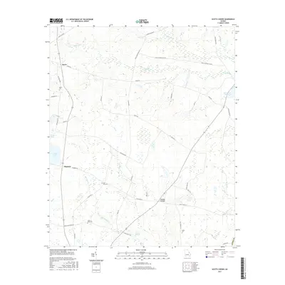
2017 Map of Scotts Corner
USGS Topo · Published 2017About this map
Agricultural lands and creek drainages define the landscape of eastern Georgia near the crossroads of Magruder and Scotts Corner. The area is marked by a legacy of family and community burial grounds, including the Rosier Cem, Bark Camp Cem, and the Cason- Bynes Cem, which serve as vital touchstones for genealogical research in this rural pocket of Burke County.
Find a feature on this map
41 named features on this map. Tap any name to fly to it.
Don’t see what you’re looking for? This feature index may not catch every label — zoom into the map to look around manually.
Map Details
Editions of this 2017 Scotts Corner Map
This is the sole edition of this map. No revisions or reprints were ever made.
Other maps of this area

1919 · Gough
USGS Topo · 1:62,500

1920 · Stapleton
USGS Topo · 1:62,500

1948 · Stapleton
USGS Topo · 1:62,500

1948 · Gough
USGS Topo · 1:62,500
1950 · Waynesboro
USGS Topo · 1:24,000
1950 · Gough
USGS Topo · 1:24,000

1950 · Kellys Pond
USGS Topo · 1:24,000

1953 · Athens
USGS Topo · 1:250,000

1957 · Macon
USGS Topo · 1:250,000

1958 · Macon
USGS Topo · 1:250,000