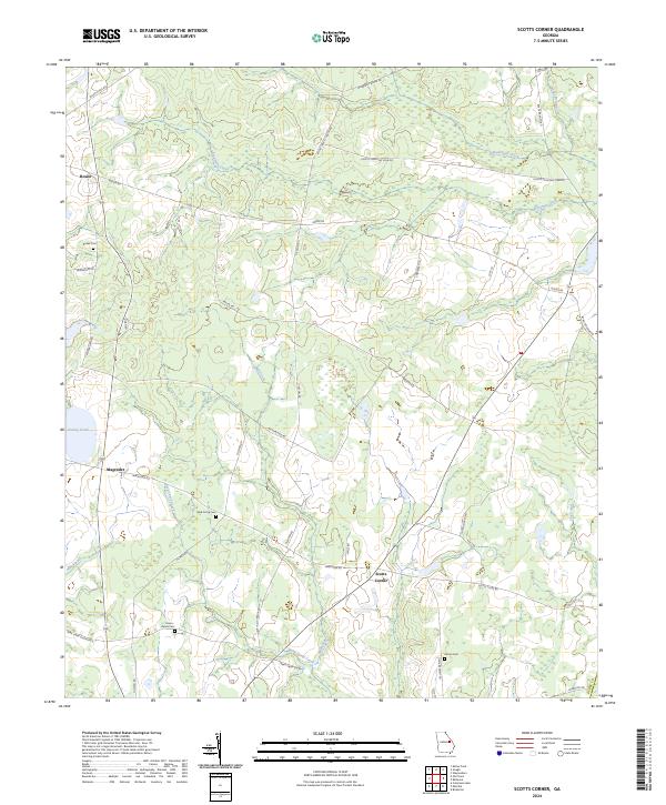
2024 Map of Scotts Corner
USGS Topo · Published 2024About this map
Rosier and the surrounding agricultural landscapes of Burke County are defined by a network of rural routes and slow-moving waterways. The area near Scotts Corner and Magruder is characterized by small-scale settlements and family-named landmarks that hint at generations of local residency. Much of the terrain is drained by Eightmile Creek and Bark Camp Creek, where the land is punctuated by quiet water features like Turkey Pond.
Find a feature on this map
42 named features on this map. Tap any name to fly to it.
Don’t see what you’re looking for? This feature index may not catch every label — zoom into the map to look around manually.
Map Details
Editions of this 2024 Scotts Corner Map
This is the sole edition of this map. No revisions or reprints were ever made.
Other maps of this area

1919 · Gough
USGS Topo · 1:62,500

1920 · Stapleton
USGS Topo · 1:62,500

1948 · Stapleton
USGS Topo · 1:62,500

1948 · Gough
USGS Topo · 1:62,500
1950 · Waynesboro
USGS Topo · 1:24,000
1950 · Gough
USGS Topo · 1:24,000

1950 · Kellys Pond
USGS Topo · 1:24,000

1953 · Athens
USGS Topo · 1:250,000

1957 · Macon
USGS Topo · 1:250,000

1958 · Macon
USGS Topo · 1:250,000