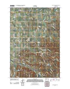
2011 Map of Scotts Mills
USGS Topo · Published 2011About this map
Butte Creek and Abiqua Creek define the drainage of this landscape, where the foothills meet the agricultural floor of the Willamette Valley. The town of Scotts Mills serves as a focal point near the center of the sheet, supported by the Scotts Mills Post Office and nearby Maplewood Cemetery. The map documents a network of rural settlements and named junctions including Marquam, Monitor, and Gladtidings, connected by a web of established roads like S Monte Cristo Rd and S Gibson Rd. Genealogists will find several family-named landmarks and burial sites, including the Miller Cemetery and Valley View Cemetery. Notable crossings such as Nowlen Bridge, Jacks Bridge, and Dunagan Bridge illustrate the importance of local watercourses to the area's transit and historic development.
Find a feature on this map
79 named features on this map. Tap any name to fly to it.
Don’t see what you’re looking for? This feature index may not catch every label — zoom into the map to look around manually.
Map Details
Editions of this 2011 Scotts Mills Map
This is the sole edition of this map. No revisions or reprints were ever made.
Other maps of this area

1923 · Mount Angel
USGS Topo · 1:62,500

1925 · Stayton
USGS Topo · 1:62,500

1939 · Molalla
USGS Topo · 1:62,500

1940 · Molalla
USGS Topo · 1:62,500

1940 · Mount Angel
USGS Topo · 1:62,500

1941 · Stayton
USGS Topo · 1:62,500

1948 · Vancouver
USGS Topo · 1:250,000

1950 · Vancouver
USGS Topo · 1:250,000

1950 · Vancouver
USGS Topo · 1:250,000

1951 · Lyons
USGS Topo · 1:62,500