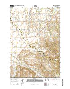
2014 Map of Scotts Mills
USGS Topo · Published 2014About this map
Butte Cr and Abiqua Cr carve through the landscape of the Willamette Valley’s eastern edge, defining the boundaries and settlement patterns of this Marion and Clackamas County borderland. The town of Scotts Mills sits at the heart of the district, where the terrain transitions from the level expanses of Elliott Prairie in the north toward the rising elevations of Missouri Ridge in the southeast. This survey captures a rural network of small communities like Monitor, Marquam, and Oaklawn, connected by a series of crossings such as Nowlen Bridge and Jacks Bridge. Local history is anchored in the several cemeteries serving the farmsteads, including Maplewood Cem and Miller Cem. The abundance of water resources is evident in the numerous drainages like Muddy Cr and Thomas Cr, alongside man-made features like Marquam Reservoir and Loe's Reservoirs, which support the region's agricultural character.
Find a feature on this map
84 named features on this map. Tap any name to fly to it.
Don’t see what you’re looking for? This feature index may not catch every label — zoom into the map to look around manually.
Map Details
Editions of this 2014 Scotts Mills Map
This is the sole edition of this map. No revisions or reprints were ever made.
Other maps of this area

1923 · Mount Angel
USGS Topo · 1:62,500

1925 · Stayton
USGS Topo · 1:62,500

1939 · Molalla
USGS Topo · 1:62,500

1940 · Molalla
USGS Topo · 1:62,500

1940 · Mount Angel
USGS Topo · 1:62,500

1941 · Stayton
USGS Topo · 1:62,500

1948 · Vancouver
USGS Topo · 1:250,000

1950 · Vancouver
USGS Topo · 1:250,000

1950 · Vancouver
USGS Topo · 1:250,000

1951 · Lyons
USGS Topo · 1:62,500