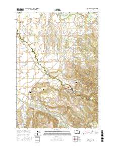
2017 Map of Scotts Mills
USGS Topo · Published 2017About this map
Scotts Mills sits along the southern edge of this landscape where Butte Cr carves through the foothills between Marion and Clackamas counties. The area is characterized by agricultural expansion across the level Elliott Prairie and Oaklawn to the north, contrasted with the rising elevations of Missouri Ridge to the southeast. Settled communities such as Monitor and Marquam serve as focal points for a network of rural roads, including S Kroff Rd and Mt Angel Scotts Mills Rd NE. Local history is anchored by several burial sites, including the Maplewood Pioneer Cem and Miller Cem, which provide genealogical touchpoints for the region's early families. Water resources are prominent, with Marquam Reservoir and Drescher Reservoir supporting local needs, while numerous spans like Monitor Bridge and Jacks Bridge facilitate travel across the winding creeks.
Find a feature on this map
97 named features on this map. Tap any name to fly to it.
Don’t see what you’re looking for? This feature index may not catch every label — zoom into the map to look around manually.
Map Details
Editions of this 2017 Scotts Mills Map
This is the sole edition of this map. No revisions or reprints were ever made.
Other maps of this area

1923 · Mount Angel
USGS Topo · 1:62,500

1925 · Stayton
USGS Topo · 1:62,500

1939 · Molalla
USGS Topo · 1:62,500

1940 · Molalla
USGS Topo · 1:62,500

1940 · Mount Angel
USGS Topo · 1:62,500

1941 · Stayton
USGS Topo · 1:62,500

1948 · Vancouver
USGS Topo · 1:250,000

1950 · Vancouver
USGS Topo · 1:250,000

1950 · Vancouver
USGS Topo · 1:250,000

1951 · Lyons
USGS Topo · 1:62,500