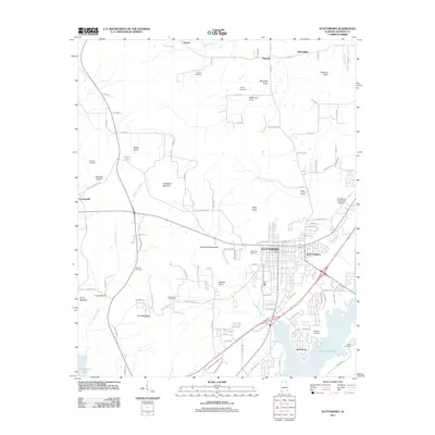
2011 Map of Scottsboro
USGS Topo · Published 2011About this map
Scottsboro serves as the focal point of this Jackson County survey, situated at the edge of the expansive Guntersville Lake. The landscape is defined by its dramatic topographic relief, where the flat agricultural lands of Roseberry Bottoms and Sauty Bottoms meet the rising elevations of Poorhouse Mountain and July Mountain. The transition between the low-lying river valley and the elevated coves is marked by a series of named hollows and pockets, including Maynard Cove and Woods Cove. This geography historically shaped the settlement patterns of smaller communities like Larkinsville, Pikeville, and Tupelo, which are connected by a network of county roads. For the family historian, the map reveals numerous small burial grounds dispersed through the terrain, such as Shelton Cemetery and Liberty Cemetery in the north, providing a window into the rural layout of the region before modern development reached the outskirts of the Webb Addition.
Find a feature on this map
111 named features on this map. Tap any name to fly to it.
Don’t see what you’re looking for? This feature index may not catch every label — zoom into the map to look around manually.
Map Details
Editions of this 2011 Scottsboro Map
This is the sole edition of this map. No revisions or reprints were ever made.
Other maps of this area

1886 · Stevenson
USGS Topo · 1:125,000

1888 · Scottsboro
USGS Topo · 1:125,000

1892 · Scottsboro
USGS Topo · 1:125,000

1892 · Stevenson
USGS Topo · 1:125,000

1895 · Stevenson
USGS Topo · 1:125,000

1936 · Scottsboro
USGS Topo · 1:24,000

1936 · Wannville
USGS Topo · 1:24,000

1936 · Langston
USGS Topo · 1:24,000

1936 · Mud Creek
USGS Topo · 1:24,000

1936 · Dutton
USGS Topo · 1:24,000