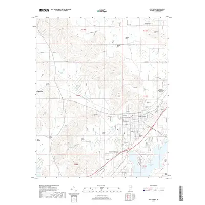
2018 Map of Scottsboro
USGS Topo · Published 2018About this map
Scottsboro and its northern surroundings are defined by a rhythmic geography of limestone coves and ridges, where the Tennessee River valley meets the southern Cumberland Plateau. The landscape transition is evident in the many named coves like Maynard Cove and Woods Cove, which provided flat, fertile land for early settlement. For genealogists, the map is remarkably dense with family-named landmarks and burial sites, including the Shelton Cem, Rosson Cem, and Tipton Cem. The modern town structure, including the Webb Addition and the Scottsboro Municipal Airport-Word Field, contrasts with the older, smaller communities of Larkinsville and Pikeville. In the south, the waters of Guntersville Lake follow the irregular contours of the valley, bounded by prominent features like Backbone Ridge and River Ridge.
Find a feature on this map
142 named features on this map. Tap any name to fly to it.
Don’t see what you’re looking for? This feature index may not catch every label — zoom into the map to look around manually.
Map Details
Editions of this 2018 Scottsboro Map
This is the sole edition of this map. No revisions or reprints were ever made.
Other maps of this area

1886 · Stevenson
USGS Topo · 1:125,000

1888 · Scottsboro
USGS Topo · 1:125,000

1892 · Scottsboro
USGS Topo · 1:125,000

1892 · Stevenson
USGS Topo · 1:125,000

1895 · Stevenson
USGS Topo · 1:125,000

1936 · Scottsboro
USGS Topo · 1:24,000

1936 · Wannville
USGS Topo · 1:24,000

1936 · Langston
USGS Topo · 1:24,000

1936 · Mud Creek
USGS Topo · 1:24,000

1936 · Dutton
USGS Topo · 1:24,000