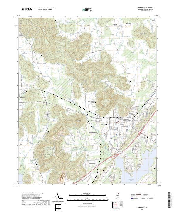
2024 Map of Scottsboro
USGS Topo · Published 2024About this map
Scottsboro serves as the central hub of this Jackson County landscape, anchored by the Jackson County Courthouse and sprawling outward into newer developments like Webb Addition. The map reveals a transition from the urban grid to the distinctive topography of the Cumberland Plateau, where the city is hemmed in by Backbone Ridge and Poorhouse Mtn. This intersection of geography and history is evident in the numerous burial grounds marking the hillsides, such as the Old Stage Coach Station Cem and the sprawling Cedar Hill Cem. To the north, the terrain breaks into deep valleys including Maynard Cove and McBroom Cove, while the southern edge meets the waters of Guntersville Lake. Small, established communities like Pikeville, Blackankle, and Larkinsville surround the city, connected by an intricate network of county roads that navigate the complex ridges and hollows.
Find a feature on this map
166 named features on this map. Tap any name to fly to it.
Don’t see what you’re looking for? This feature index may not catch every label — zoom into the map to look around manually.
Map Details
Editions of this 2024 Scottsboro Map
This is the sole edition of this map. No revisions or reprints were ever made.
Other maps of this area

1886 · Stevenson
USGS Topo · 1:125,000

1888 · Scottsboro
USGS Topo · 1:125,000

1892 · Scottsboro
USGS Topo · 1:125,000

1892 · Stevenson
USGS Topo · 1:125,000

1895 · Stevenson
USGS Topo · 1:125,000

1936 · Scottsboro
USGS Topo · 1:24,000

1936 · Wannville
USGS Topo · 1:24,000

1936 · Langston
USGS Topo · 1:24,000

1936 · Mud Creek
USGS Topo · 1:24,000

1936 · Dutton
USGS Topo · 1:24,000