
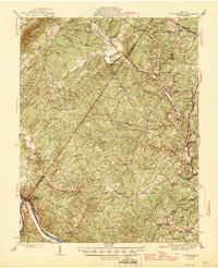
1946 Map of Scottsville
USGS Topo · Published 1946About this map
Scottsville serves as a focal point where the James River and the Chesapeake and Ohio railroad corridor meet, defining the southern edge of this mid-1940s landscape. Further north, the Rivanna River winds past Palmyra and Union Mills, illustrating a region historically tied to water power and early transit. Notable rural landmarks like Ash Lawn and Simeon sit near the northern boundary, while the countryside is dotted with small community centers such as Kidds Store and Central Plains. This map reveals a settled agricultural and residential pattern, marked by numerous small schools like Garland Sch and Woodridge Sch, and country churches such as Wesley Chapel and Mt Eagle Ch. The inclusion of the University Airport and a Fire Tower on Carters Mountain indicates the modernization of regional infrastructure during the late war years.
Find a feature on this map
76 named features on this map. Tap any name to fly to it.
Don’t see what you’re looking for? This feature index may not catch every label — zoom into the map to look around manually.
Map Details
Editions of this 1946 Scottsville Map
2 editions found
Other maps of this area

1891 · Palmyra
USGS Topo · 1:125,000

1892 · Buckingham
USGS Topo · 1:125,000

1892 · Gordonsville
USGS Topo · 1:125,000

1892 · Harrisonburg
USGS Topo · 1:125,000

1895 · Palmyra
USGS Topo · 1:125,000

1897 · Palmyra
USGS Topo · 1:125,000

1929 · Covesville
USGS Topo · 1:62,500

1931 · University
USGS Topo · 1:62,500

1935 · Charlottesville
USGS Topo · 1:62,500

1935 · Charlottesville And Vicinity
USGS Topo · 1:31,680