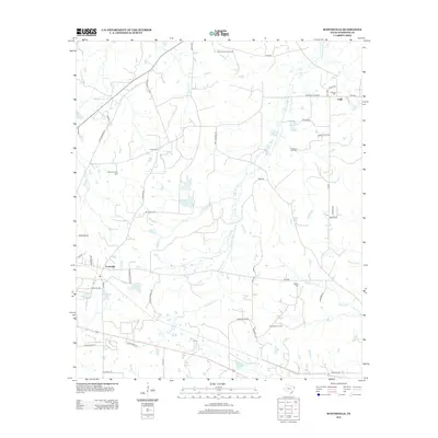
2013 Map of Scottsville
USGS Topo · Published 2013About this map
Harrison Bayou meanders through the heart of this East Texas landscape, defining a network of wetlands and creeks that drain toward the northeast. The area around Scottsville reflects a legacy of family landholdings and rural industry, most notably the Scottsville Oil Field and various family-named roads like John Sanders Rd and Julius Davis Ln. Local history is deeply etched into the terrain through a high concentration of cemeteries, including Antioch Cem, Mimosa Hall Cem, and Scott Cem. These sites, along with the settlement at Leigh, provide significant points of interest for genealogists tracking family roots in Harrison County. Infrastructure such as the Karnack Lookout Tower and a complex system of farm-to-market roads, like FM-134, connects these dispersed rural communities and resource extraction sites.
Find a feature on this map
51 named features on this map. Tap any name to fly to it.
Don’t see what you’re looking for? This feature index may not catch every label — zoom into the map to look around manually.
Map Details
Editions of this 2013 Scottsville Map
This is the sole edition of this map. No revisions or reprints were ever made.
Other maps of this area

1943 · Waskom
USGS Topo · 1:62,500

1944 · Caddo Lake
USGS Topo · 1:62,500

1945 · Waskom
USGS Topo · 1:62,500

1946 · Caddo Lake
USGS Topo · 1:62,500

1956 · Tyler
USGS Topo · 1:250,000

1958 · Darco
USGS Topo · 1:62,500

1962 · Woodlawn
USGS Topo · 1:24,000
1962 · Potters Point
USGS Topo · 1:24,000
1962 · Karnack
USGS Topo · 1:24,000

1962 · Stricklin Springs
USGS Topo · 1:24,000