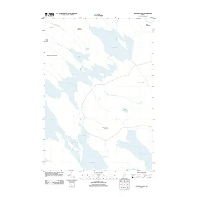
2011 Map of Scraggly Lake
USGS Topo · Published 2011About this map
Scraggly Lake and its intricate network of surrounding waters dominate this section of the Maine interior. The landscape is defined by a series of interconnected water bodies, including the expansive West Grand Lake to the south and Pleasant Lake to the north, separated by prominent topographical features such as Pleasant Lake Ridge and Penobscot Bald Mountain. This 2011 survey documents a territory where few roads, such as Amazon Rd and Getchell Mountain Rd, penetrate the heavy shoreline cover. The presence of smaller basins like Pork Barrel Lake and Pug Lake illustrates the glacial-carved character of the region, while Whitney Cove Mountain stands as a landmark overlooking the northern reaches of West Grand Lake.
Find a feature on this map
26 named features on this map. Tap any name to fly to it.
Don’t see what you’re looking for? This feature index may not catch every label — zoom into the map to look around manually.
Map Details
Editions of this 2011 Scraggly Lake Map
This is the sole edition of this map. No revisions or reprints were ever made.
Other maps of this area

1931 · Springfield
USGS Topo · 1:48,000

1932 · Nicatous Lake
USGS Topo · 1:48,000

1934 · Nicatous Lake
USGS Topo · 1:62,500

1934 · Springfield
USGS Topo · 1:62,500

1941 · Scraggly Lake
USGS Topo · 1:62,500

1941 · Wabassus Lake
USGS Topo · 1:62,500

1943 · Wabassus Lake
USGS Topo · 1:62,500

1944 · Scraggly Lake
USGS Topo · 1:62,500

1953 · Wabassus Lake
USGS Topo · 1:62,500

1954 · Millinocket
USGS Topo · 1:250,000