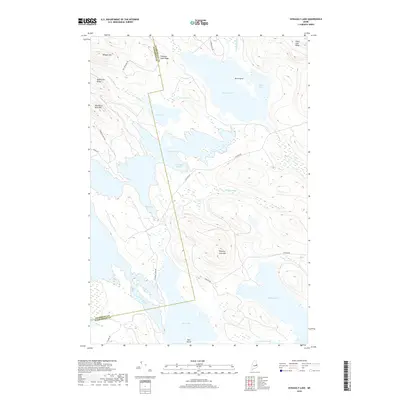
2018 Map of Scraggly Lake
USGS Topo · Published 2018About this map
The Penobscot Co Washington Co line bisects this remote water-connected landscape in Carroll Plantation, where massive lakes and elevated ridges dominate the geography. The central water complex of Scraggly Lake and Shaw Lake is linked by a network of drainage features including Horsehill Brook and Rainey Brook. High elevations such as Penobscot Bald Mtn and Whitney Cove Mtn rise sharply from the shoreline, while lower-lying Mud Cove and Junior Bay provide access to the extensive wetland systems at the south. A sparse network of logging and access routes, including Amazon Rd and Mill Privilege Rd, serves as the primary human footprint through the timberlands. The prominence of family-named features like Denbow Brook and McLellan Cove suggests the long-standing recreational and resource-management history of this corner of Maine.
Find a feature on this map
30 named features on this map. Tap any name to fly to it.
Don’t see what you’re looking for? This feature index may not catch every label — zoom into the map to look around manually.
Map Details
Editions of this 2018 Scraggly Lake Map
This is the sole edition of this map. No revisions or reprints were ever made.
Other maps of this area

1931 · Springfield
USGS Topo · 1:48,000

1932 · Nicatous Lake
USGS Topo · 1:48,000

1934 · Nicatous Lake
USGS Topo · 1:62,500

1934 · Springfield
USGS Topo · 1:62,500

1941 · Scraggly Lake
USGS Topo · 1:62,500

1941 · Wabassus Lake
USGS Topo · 1:62,500

1943 · Wabassus Lake
USGS Topo · 1:62,500

1944 · Scraggly Lake
USGS Topo · 1:62,500

1953 · Wabassus Lake
USGS Topo · 1:62,500

1954 · Millinocket
USGS Topo · 1:250,000