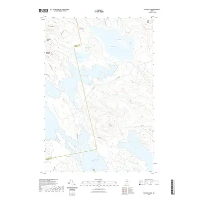
2021 Map of Scraggly Lake
USGS Topo · Published 2021About this map
Scraggly Lake and Pleasant Lake dominate this interconnected wilderness of water and ridgelines along the border of Penobscot and Washington counties. This modern topographic survey highlights a landscape defined by significant elevation changes, from the heights of Penobscot Bald Mtn and Whitney Cove Mtn down to the sprawling bays of Junior Lake and West Grand Lake. The absence of dense residential development is contrasted by a network of specialized access routes such as Amazon Rd, Mill Privilege Rd, and Penobscot Mnt Rd, which weave between glacial landforms like Trout Lake Ridge and Pleasant Lake Ridge. The map details many intricate shoreline features, including Mud Cove, Dark Cove, and Bear Island, tracing the flow of Junior Stream and numerous brooks that feed this major recreational lake system.
Find a feature on this map
32 named features on this map. Tap any name to fly to it.
Don’t see what you’re looking for? This feature index may not catch every label — zoom into the map to look around manually.
Map Details
Editions of this 2021 Scraggly Lake Map
This is the sole edition of this map. No revisions or reprints were ever made.
Other maps of this area

1931 · Springfield
USGS Topo · 1:48,000

1932 · Nicatous Lake
USGS Topo · 1:48,000

1934 · Nicatous Lake
USGS Topo · 1:62,500

1934 · Springfield
USGS Topo · 1:62,500

1941 · Scraggly Lake
USGS Topo · 1:62,500

1941 · Wabassus Lake
USGS Topo · 1:62,500

1943 · Wabassus Lake
USGS Topo · 1:62,500

1944 · Scraggly Lake
USGS Topo · 1:62,500

1953 · Wabassus Lake
USGS Topo · 1:62,500

1954 · Millinocket
USGS Topo · 1:250,000