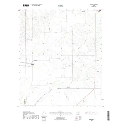
2019 Map of Scranton
USGS Topo · Published 2019About this map
Scranton and Nimrod anchor this rural landscape in Eastland County, where the terrain is shaped by the winding course of the S Fork Leon River and its tributary, Dinner Br. The map reveals a network of rural routes such as Ranch Rd 1864 and Ranch Rd 569 that connect these small communities to the larger hub of Cisco in the northeast corner. Genealogists will find significant value in the documentation of local burial sites, including Mitchell Cem, Pisgah Cem, and Haskell Cem, which are scattered across the West Texas ranch land. Near the city of Cisco, the Gregory M Simmons Memorial Airport serves as a prominent modern landmark amidst a landscape otherwise defined by traditional land use and the dividing line between Callahan and Eastland counties.
Find a feature on this map
44 named features on this map. Tap any name to fly to it.
Don’t see what you’re looking for? This feature index may not catch every label — zoom into the map to look around manually.
Map Details
Editions of this 2019 Scranton Map
This is the sole edition of this map. No revisions or reprints were ever made.
Other maps of this area

1894 · Eastland
USGS Topo · 1:125,000

1931 · Baird
USGS Topo · 1:125,000

1932 · Baird
USGS Topo · 1:125,000

1954 · Abilene
USGS Topo · 1:250,000

1958 · Abilene
USGS Topo · 1:250,000

1966 · Cisco North
USGS Topo · 1:24,000

1966 · Scranton
USGS Topo · 1:24,000

1966 · Putnam South
USGS Topo · 1:24,000
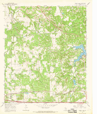
1966 · Bernie Lake
USGS Topo · 1:24,000

1966 · Cisco South
USGS Topo · 1:24,000