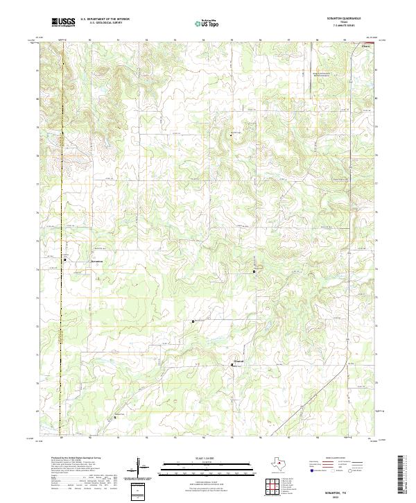
2022 Map of Scranton
USGS Topo · Published 2022About this map
The upper reaches of the S Fork Leon River wind through this section of the Texas landscape, carving a drainage pattern across the border of Callahan and Eastland counties. This rural area is characterized by small, dispersed settlements like Scranton and Nimrod, which appear as quiet crossroads defined by their local history. A notable concentration of burial sites, including the Scranton Cem, Nimrod Cem, and Pisgah Cem, offers significant evidence of the region’s early families and pioneer-era church communities. The northern edge of the map features the southern outskirts of Cisco and the Gregory M Simmons Memorial Airport, where the terrain begins to transition from agricultural creek bottoms toward more developed transportation corridors. Smaller waterways like Dinner Br feed into the river system, supporting the ranching and farming operations that have long sustained these West Texas communities.
Find a feature on this map
47 named features on this map. Tap any name to fly to it.
Don’t see what you’re looking for? This feature index may not catch every label — zoom into the map to look around manually.
Map Details
Editions of this 2022 Scranton Map
This is the sole edition of this map. No revisions or reprints were ever made.
Other maps of this area

1894 · Eastland
USGS Topo · 1:125,000

1931 · Baird
USGS Topo · 1:125,000

1932 · Baird
USGS Topo · 1:125,000

1954 · Abilene
USGS Topo · 1:250,000

1958 · Abilene
USGS Topo · 1:250,000

1966 · Cisco North
USGS Topo · 1:24,000

1966 · Scranton
USGS Topo · 1:24,000

1966 · Putnam South
USGS Topo · 1:24,000
1966 · Bernie Lake
USGS Topo · 1:24,000

1966 · Cisco South
USGS Topo · 1:24,000