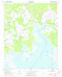
1951 Map of Scranton
USGS Topo · Published 1977About this map
The coastal lowlands of Hyde County meet the Pamlico River in this mid-century survey, revealing a landscape defined by intricate tidal creeks and rural crossroads. The settlement of Scranton sits at the head of Scranton Creek, while to the south, the community of Germantown overlooks Germantown Bay. This area illustrates the transition from inland agriculture to protected marshes, with the vast Swanquarter National Wildlife Refuge dominating the eastern shoreline along Rose Bay.
Find a feature on this map
58 named features on this map. Tap any name to fly to it.
Don’t see what you’re looking for? This feature index may not catch every label — zoom into the map to look around manually.
Map Details
Editions of this 1951 Scranton Map
2 editions found
Other maps of this area

1914 · Belhaven
USGS Topo · 1:48,000

1916 · Belhaven
USGS Topo · 1:62,500

1943 · Columbia
USGS Topo · 1:125,000

1943 · Plymouth
USGS Topo · 1:125,000

1950 · Lowland
USGS Topo · 1:24,000

1951 · Pamlico Point
USGS Topo · 1:24,000

1951 · Great Island
USGS Topo · 1:24,000

1951 · Pamlico Beach
USGS Topo · 1:24,000

1951 · Belhaven
USGS Topo · 1:24,000

1951 · Scranton
USGS Topo · 1:24,000