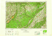
1959 Map of Scranton
USGS Topo · Published 1959About this map
The Pocono Mountains and Catskill Mountains dominate this mid-century topographic perspective of the tri-state intersection between Pennsylvania, New York, and New Jersey. Industry and transit are clearly defined by the heavy presence of the Erie Railroad and Delaware Lackawanna and Western RR, which connect the anthracite coal regions around Scranton and Wilkes-Barre to the larger markets of the east. This 1959 edition captures the landscape before the full maturation of the Interstate Highway System, showing the New York State Thruway in its earlier configuration alongside established routes like U S 6 and U S 209. Large-scale water management projects are a striking feature, with the Pepacton Reservoir, Ashokan Reservoir, and Lake Wallenpaupack serving as massive landmarks within the Delaware and Hudson river basins.
Find a feature on this map
99 named features on this map. Tap any name to fly to it.
Don’t see what you’re looking for? This feature index may not catch every label — zoom into the map to look around manually.
Map Details
Editions of this 1959 Scranton Map
2 editions found

Other maps of this area

1888 · Franklin
USGS Topo · 1:62,500

1888 · Morristown
USGS Topo · 1:62,500

1888 · Hackettstown
USGS Topo · 1:62,500

1888 · Lake Hopatcong
USGS Topo · 1:62,500

1888 · Paterson
USGS Topo · 1:62,500

1889 · Scranton
USGS Topo · 1:62,500

1889 · Hazleton
USGS Topo · 1:62,500

1891 · Greenwood Lake
USGS Topo · 1:62,500

1891 · Ramapo
USGS Topo · 1:62,500

1891 · Wilkesbarre
USGS Topo · 1:62,500