
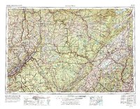
1962 Map of Scranton
USGS Topo · Published 1977About this map
The Scranton and Wilkes-Barre industrial corridor anchor the southwestern corner of this mid-century landscape, where coal mining and manufacturing shaped a dense network of valley settlements like Carbondale and Pittston. Rising from the river valleys, the Pocono Mountains and Catskill Mountains define the high terrain, punctuated by massive water projects including the Ashokan Reservoir and Wallenpaupack Lake.
Find a feature on this map
188 named features on this map. Tap any name to fly to it.
Don’t see what you’re looking for? This feature index may not catch every label — zoom into the map to look around manually.
Map Details
Editions of this 1962 Scranton Map
2 editions found
Other maps of this area

1888 · Franklin
USGS Topo · 1:62,500

1888 · Morristown
USGS Topo · 1:62,500

1888 · Hackettstown
USGS Topo · 1:62,500

1888 · Lake Hopatcong
USGS Topo · 1:62,500

1888 · Paterson
USGS Topo · 1:62,500

1889 · Scranton
USGS Topo · 1:62,500

1889 · Hazleton
USGS Topo · 1:62,500

1891 · Greenwood Lake
USGS Topo · 1:62,500

1891 · Ramapo
USGS Topo · 1:62,500

1891 · Wilkesbarre
USGS Topo · 1:62,500