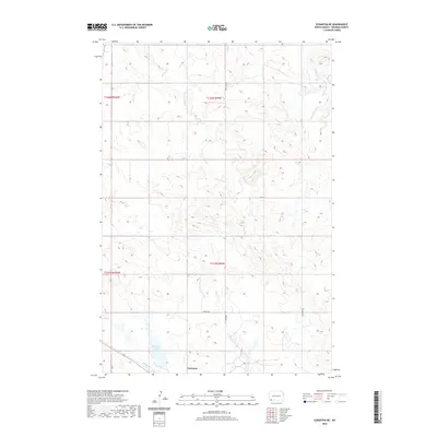
2020 Map of Scranton NE
USGS Topo · Published 2020About this map
Gascoyne sits at the southern edge of this North Dakota landscape, a small settlement defined by its proximity to the waters of Gascoyne Lake. The terrain is shaped by the winding courses of Buffalo Cr and South Cedar Cr, which carve through the high plains. A clear sense of the local infrastructure is evident in the presence of Mine Rd and the evocatively named Whiskey Rd, reflecting the region's transport and industrial patterns during this era. The map provides a detailed view of the township and range boundaries, including t131n r99w, which organize the rural property lines and agricultural plots characteristic of Bowman County.
Find a feature on this map
10 named features on this map. Tap any name to fly to it.
Don’t see what you’re looking for? This feature index may not catch every label — zoom into the map to look around manually.
Map Details
Editions of this 2020 Scranton NE Map
This is the sole edition of this map. No revisions or reprints were ever made.
Other maps of this area

1953 · Dickinson
USGS Topo · 1:250,000

1957 · Dickinson
USGS Topo · 1:250,000

1969 · Scranton
USGS Topo · 1:24,000

1969 · Gascoyne
USGS Topo · 1:24,000

1969 · Reeder
USGS Topo · 1:24,000

1969 · Scranton NE
USGS Topo · 1:24,000

1973 · Warnke Hill
USGS Topo · 1:24,000

1973 · Mineral Springs
USGS Topo · 1:24,000
1973 · Scranton SW
USGS Topo · 1:24,000

1973 · Cedar Lake
USGS Topo · 1:24,000